Historical Walk

Click the following LINK to print the DBIA Historical Tour map.


Start your tour along the Walking Path on the west side of the river; behind the Quinte West Chamber of Commerce at 97 Front St.

In 1615 Samuel De Champlain voyaged through the Trent River from The Saint Lawrence with over 300 Algonquian and Huron-Wendat Natives, mapping the river and portaging in the area during their voyage. Although there is speculation that he had visited Mount Pelion there is more evidence to suggest that Samuel De Champlain stayed in Carrying Place with his crew before continuing their journey. The river was named after the River Trent in England despite Champlain being French.

Trent Port & Bleecker Ferry- in 1778 John Myer a loyalist captain requested the government for land to build a sawmill on the shore of the Trent River but was denied, his son in law 6 years later happened to acquire the said property along the Trent River and built himself a log house, the area being titled ‘Bleecker’s Grove. He then used this settlement to operate a Ferry taking passengers and/or their horses across the river. After his death at the age of 45, his wife Mary Bleecker operated the Ferry and an Inn, and the area became retitled “Trent Port”. Trent Port evolved into a series of docks along the water, and in 1833 a bridge was built crossing the river, putting the Bleecker Ferry out of business.

Continue on the path going south towards Dundas St. until your are facing the bridge.

The Bridge- the current bridge crossing over the Trent River was constructed in 1990, the first bridge to cross the Trent River was built in 1833 and was a large, covered, flat, wooden bridge. The bridge took tolls for crossing and continued to take tolls into the latter half of the 1800s. Eventually in 1960 Trenton built a new bridge to replace the old wooden one, this time an iron bridge with a swing section for boats traveling down the river. Then in 1990, the iron bridge was replaced with the current bridge crossing the Trent River today, removing the swing feature in favor of an arching structure that allows boats to pass under without waiting and keep land traffic flowing over the bridge.

David Gilmour- David Gilmour, otherwise known as the Lumber Baron, was one of the largest entrepreneurs in Trenton during the 1800s, owning a lumbering company producing doors, windows, and other woodworking products. David Gilmour was the first man to bring gas-powered light to Trenton as a way to allow his company’s production to continue through the night, Gilmour was also the first person to own a telephone in Trenton. In 1881 Gilmour was elected reeve (the equivalent to Mayor) and focused his effort on bringing water power to Trenton using the river, and eventually, in 1885 the people agreed to build the dam on Gilmour’s property and was given 25,000 dollars to do so.

To learn more, click HERE to watch a documentary by Sean Scally entitled Lumberbaron: The Gilmour Years and discover the story of the Gilmour Lumber Company’s impact on Trenton and the surrounding region.

Continue on the path until you enter Fraser Park. 

When you enter Fraser Park, you will see a large industrial grey building along the water. This is Trenton Cold Storage, established in 1902, and it is Trenton’s oldest business still standing today. In the 19th and early 20th centuries, the Trent River was a laboring site in the winter for ice harvesting, where large blocks of ice were skimmed from the river. Most prominently, this ice was sent directly to Trenton Cold Storage’s ice houses, where it was used for summer cooling, food storage, and other needs. Today, this refrigerated warehousing and distribution company delivers across Canada and the United States.

Continuing along the Fraser Park path, you will come to the Fraser Park Gates.

Fraser Park Gates- The Fraser Park Gates was commissioned by The Imperial Order of Daughters of the Empire, a Canadian women’s charity Organization founded in 1900. The gates were built as a memorial after the First and Second World Wars.

As you exit Fraser Park through the gate, you will see the cenotaph directly ahead. As a city with a Royal Canadian Air Force base, Trenton has strong ties to our military community.

This location was previously the home to the Trenton Memorial Library, which served Trenton for 50 years until the new Quinte West Public Library opened in 2004 within the new City Hall.


Continue on according to the map, turning south towards the Bay Of Quinte. On the corner of Quinte Street is the Royal Canadian Legion Branch 110. Outside the legion is the Champlain War Plaque and Cannon.

CHAMPLAIN WAR PLAQUE AND CANON

In 1956, the Archaeological and Historic Sites Board of Ontario began erecting plaques across the province. The Provincial plaque program remains their oldest and most well-known endeavour, with over 1,270 provincial plagues and 22 international plagues placed to date. The plaque which stands outside of the Royal Canadian Legion Branch 110 describes the journey of Samuel de Champlain, a small party of Frenchmen, and around five hundred Wyandot peoples as they travelled down the Trent River. This plaque documents not only Franco-Ontarian and Indigenous heritage but serves as a reminder of Trenton’s historic ties to the Trent River. The Trent River continued to play an integral role in Trenton’s development. Trenton became first town in Ontario to develop commercial electricity from water power. The boating and tourism industry flourished in Trenton and on the Bay of Quinte. Two marinas were built to support this growth, one in Fraser Park and another at Centennial Park. In 2015 the new Trent Port Marina was completed, a premium-class municipal marina uniquely positioned to enable boaters’ easy access to our renowned waterways


** if you wish to extend your walk to visit our new Trent Port Marina, continue past the Legion towards the red roof building which is the location of Quinte West City Hall and our library

Continue on the path northeast of Fraser Park onto Albert Street towards downtown. Turn left on Dundas Street West, and you will find yourself standing in front of the Clock Tower.

CLOCK TOWER

Dominion Architect of the Department of Public Works for the Government of Canada from 1881 to 1896, more than seventy monumental post offices of his design were constructed. The best quality limestone was selected from Ox Point Quarries near Belleville, for this project. The clocks of the tower were so impressive that the tower was raised ten feet higher than the original design, to a height of ninety feet, so that the clock faces could be seen clearly from the main street.

In 1971, the existing building was demolished to make way for City Hall and a parking garage. In 1979, the tower designated as a heritage property under the Ontario Heritage Act, for architectural and historic reasons. Today only sixteen of the almost eighty original Fuller post offices still exist.

GILBERT HOTEL

Across the street at the corner of Dundas St. and Murphy St. was the location of the historical Gilbert Hotel.

Mary Bleecker, the same woman who inherited the Bleecker Ferry in Trent Port, was also the owner of many other businesses in Trenton, including the elegant and reputable Gilbert Hotel. Sir John A. Macdonald, Canada’s first Prime Minister, not only stayed at this hotel during a visit to Hastings but also addressed the people of Trenton from his room’s balcony. It is speculated that he might not have been sober while doing so, but nonetheless, his speech was listened to by the people of Trenton.

TRIPP’S CORNER

Also, across the street, at the intersection where Dundas, King, and Murphy Streets converge in downtown Trenton, is an area known as Tripp’s Corner.

Still owned by the Tripp Family today this section of Downtown is/was known as Tripp’s corner, a corner lot of local businesses (some owned by the Tripp family) in the heart of downtown. Most famously occupying the lot was The Tripp-owned Business of M.W Tripp barber shop parlor and tobacco store.

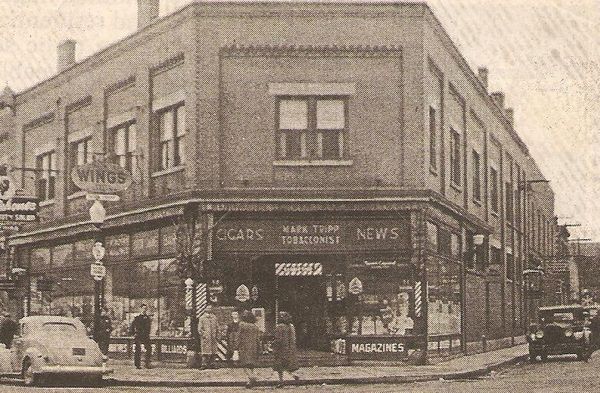
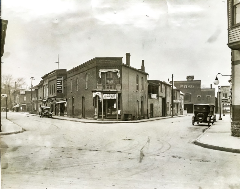
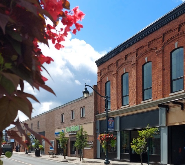
Before you continue on your tour, take a moment to look east (to your right) at the buildings along Dundas Street. You’ll see where the Bank of Montreal once occupied the building with the small round windows, now home to Whitley Insurance at 41 Dundas St W., pictured below.

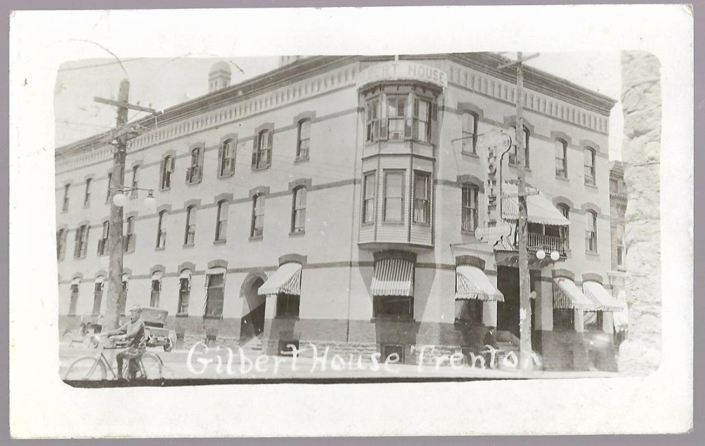
You may also see what was once the St. Lawrence Hall (Hotel). The original structure is still here today; look for #48 Dundas Street and the distinct brickwork at the top. The picture below is a photo of the St. Lawrence Hall in 1901, which boasted a fine dining room and a bar with the best liquors, wines, and cigars.

Continue west/left up Dundas Street until you meet Division Street.

As you walk along our “main street,” note that it is a section of Dundas Street W, which is part of Highway #2, an original route between what is now Toronto and Montreal.

Many banks held prominent positions along the main street of Trenton. The brick buildings that line our streets have also hosted tourists and visitors alike for centuries.

CENTRAL ONTARIO RAILWAY STATION

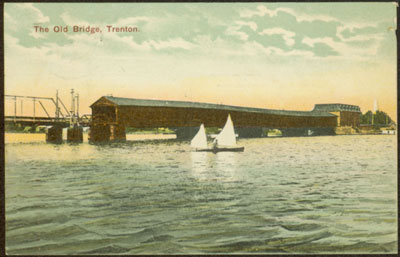
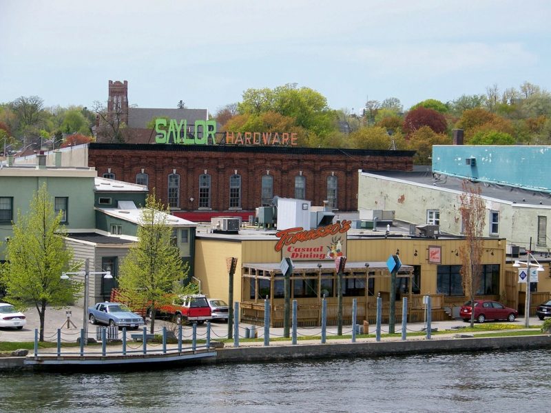
Before you leave Dundas Street W and turn right onto Division Street, take a moment to look across Dundas Street. In the early 1900s, the Central Ontario Railway had a downtown train station. Today, this location is home to Metro. This photo is from 1912.

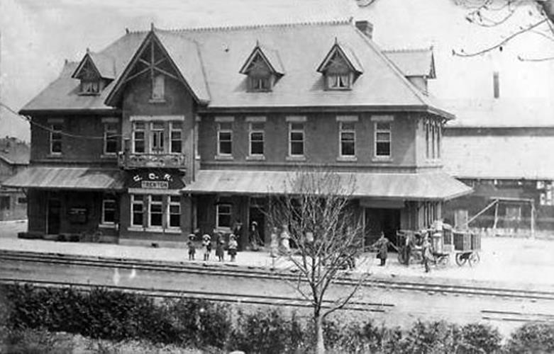
The Prince Edward railway initially ran in 1881 from Picton to Trenton junction until the idea to extend the railway across Ontario to the mines in Coe Hill was presented, and in 1882 The Prince Edward Railway then became the Central Ontario Railway. After expanding into Coe Hill and finding unprofitable mining options the railway chose to expand to avoid bankruptcy, extending to connect with the Marmora Railway. Eventually, the railway connected to the Ottawa Railway in 1910 and merged with the Canadian Northern Railway in 1911.

In 1918 the Canadian Northern Railway was acquired by the government and its assets were transferred into the national railway and majority of the CNR was removed between 1965 and 1985, all that remains is a kilometer of track located at Trenton Junction named ‘The millennium trial.

Next, it’s off to jail we go… Turn right off Dundas Street onto Division Street and walk towards the large stone building; it is our next stop.

TOWN HALL AND THE TRENT PORT HISTORICAL SOCIETY

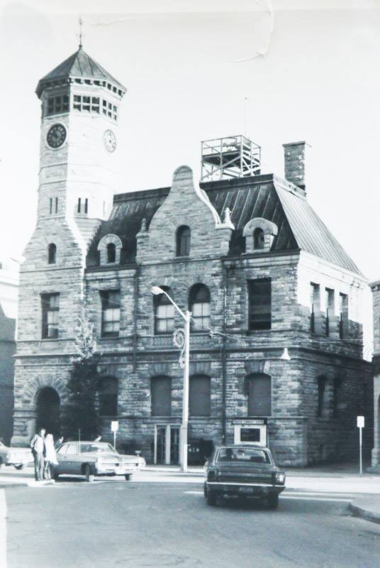
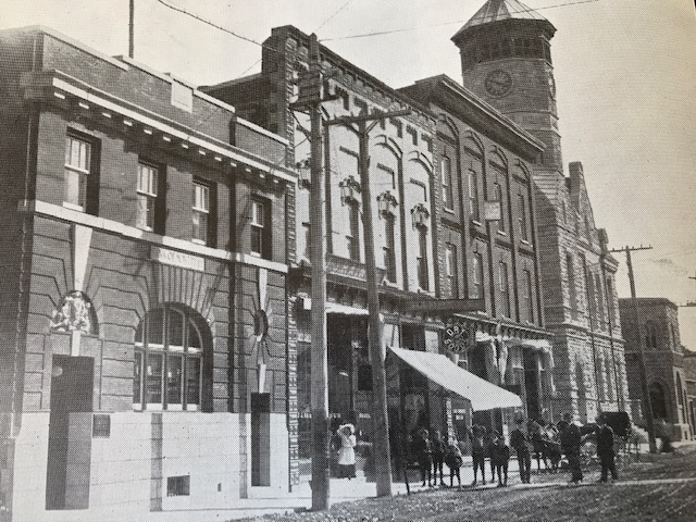
Old Town Hall – In 1861, local limestone was used to construct the market building which architect Kivas Tully designed. Aside from being municipal offices, and farmers’ market it also became the home of the Trenton police force. One jail cell and a police officer shared space with butcher stalls on the ground floor. The upper floor of the building was the home of both the Town Council and the Courtroom. When the council moved out in 1917, the building became the Trenton Police Station and remained that for approximately 70 years. Today the renovated building no longer has a wraparound porch and is our Trenton Town Hall – 1861, home of Trent Port Historical Society. They have been a valued resource in creating this walk of Trenton’s downtown. In 1983, the building was designated under the Ontario Heritage Act.

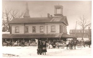
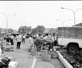
The photo below is of the Farmer’s Market in the ’70s in the Town Hall parking lot – this market has been in constant operation since 1861 and now resides on Front Street.

Continue Path East down King St. and North East Down Elgin St. towards The River, stopping in front of Foundations.

STABLE BLOCK

This corner of Town held Horse and Livery Stables and was made as a horse center for people and sailors traveling the Trent River, needing a place to house or purchase horses while they stayed to do business or leisure in Trenton.

General Blacksmith- Back in the 19th century Blacksmithing companies was an important service within Trenton, the most common service they would have provided was repairing and making horseshoes, but Blacksmiths had many general services and repairs for plows, chains, wagons, farm tools, and most metal equipment. The last Blacksmith in Trenton Cebron Yeroux closed his business recently as 1960.

Continue down Elgin Street and cross Front Street. Before crossing, look to your right (south) to see the old Saylor Block Building.

SAYLOR BLOCK

then…

NOW

The Saylor Block is one of the most significant 19th century commercial structures in Trenton. Constructed in 1877 by Samuel Cooley, the building is one of the few that survived the great fire of March 1978. Mr. Saylor Sr. had been adamant about the construction of a firewall during renovations on the neighbouring building; this was to the key to the Saylor Blocks survival. The Saylor family was in business as merchants at this location from the 1880s until 2022.

Look up to enjoy the architecture and design of this core landmark, as the new owners have renovated the building back to its original glory.

After crossing Front Street coming from Elgin Street, turn left (north) on Front Street.

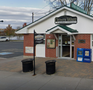
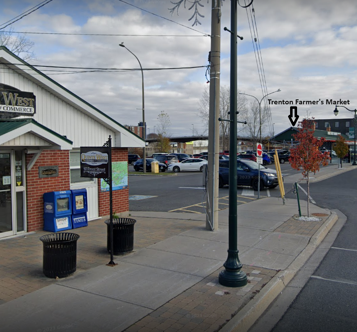
As you walk along the sidewalk, you will see the Quinte West Chamber of Commerce in front of you, and you will pass the present-day location of the Trenton Farmers Market on your right, by the Trent River

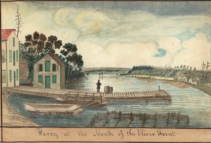
**As a point of interest, the river was named after the River Trent in England.

Continue on, to the back of the Chamber of Commerce building…

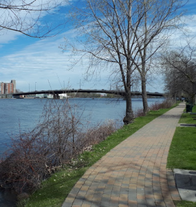
and you will be back where you started, at the River Path.

Your tour has ended!

**As you come to the end of your tour, we hope you can enjoy a beverage, meal and some shopping in Beautiful Downtown Trenton.


Trenton DBIA
29 Dundas St. W Trenton, ON
K8V 3N9


Phone 613.394.4318